On the road again.

10. March 2010

It's been a long time since my last wheel revolutions in Africa.
I've been avoiding the Black Continent, beating around the bush, choosing other cycling destinations, but now I can't delay it any more. Despite the headaches with obtaining the visas and nightmares about lions lurking in the tall grass beside the road, I must face the challenge. Besides, it's the last continent where my current touring bike hasn't been yet.

I've choosen a particulary interesting itinerary, covering Namibia, Botswana, South Africa and Lesotho. This mini "coast-to-coast" tour in Africa has all the potentials to become one of my favorites.

I have still few months until the start, so with nothing more useful to do, I started weighing my luggage. It seems I will make another record with less then 5 kg. I even shortened the cue sheet that I use instead of the map (left picture here). It's now 9,5x5,6 cm, and 0,05 grams lighter. And if you think that I am the mad one, then look what this guy has to say!

Crocs

10 June 2010

The true stars of this tour were the crocs. You know - the plastic shoes. When I picked them up I knew immediately they were my perfect choice. 325 grams for a pair, plastic that should dry in seconds if it got wet, holes to ventilate your feet. They came with warm, slipper-like inserts, to be worn in winter time. And cost only 10 euros. I added waterproof socks, to be worn if the weather would turn extremly cold or damp.
The crocs should be one size smaller than your usual shoes. My crocs were too big, so I stuffed them with plastic bags in front. Worn with short socks, they were quite comfortable. Worn with waterproof sock (left) they stayed rock solid.

Prologue: Windhoek to Swakopmund

17 August 2010

I started the tour in truly "self-sufficient" way. I packed the bike in the box, carried it from my home to the city bus station, got on the bus in rush hour, got out at the main bus station, put it on a bus to the airport and there I checked it in. On the other side of the globe I got the bike almost unscratched at the Windhoek airport, assembled it and rode for 50 km to the center of the city where I'd reserved the hostel.
Road from the airport towards Windhoek. There were not much cars, but ones that were there were blasting through at 200 km/h.

This year's set up. Less then 5 kg of luggage - including the crocs.

The next morning I was already on my way to the "official" start of the tour: Swakopmund, the little, german-flavored town on the Atlantic coast. 

The Namib desert
Atlantic beach at Swakopmund
Main Got! Ist das ein Deutches Hotel in Afrika?

Driving - nicht gut für Gesund.

Day 1: 48 km. Day 2: 185 km. Day 3: 183 km. Total: 416 km.

Through the Namib-Naukluft NP: Swakopmund to Windhoek

20 August 2010

I dipped my feet in Atlantic, it was too cold to swim. There is some symbolism in the itinerary that I've chosen for this year's tour: it goes from one coast to the other of another continent. Last year I rode North America coast-to-coast, this year it is Africa. A few more years, and I'll be around the world in stages.
Swakopmund to Valvisbai road
Seaside resort
From Swakopmund I rode to Valvisbay, then turned inland on the gravel #C14. I refilled three bottles with water in Valvisbay and bought another 0,5 l drink at the Valvisbay airport. That's 3,75 liters which should last for the next 350 km, so I thought. The first day was Ok, overcast skies, warm but not hot, I didn't use up much water. I rode two or three hours after sunset, until 21:00, then I made a camp on rock-solid ground. 

The end of asphalt at Valvisbay airport
Freedoooom, ..., Freeeedooooom

Vogelvederberg, an Uluru-like monolith
 
Aloe Dichotoma
The next day, however, was different. The mist dissolved early in the morning and by the noon the thermometer already showed 32 °C. A few hours later it was 37 °C. The road was now of an up-and-down, roller-coaster variety, with frequent, short but steep uphills with pools of soft gravel at the base of them which absorbed all your momentum as you rode into them from a previous downhill. I drank most of my water by the end of the day. According to my cue sheet, there was only one place before Windhoek (Weissenfels guestf arm) with some certainty to get water, and it was 80 km away. And there were three passes still ahead. As I laid in my tent that evening I had a few thoughts of how I might deal with the lack of water. One of them is to collect my urine in the morning. I actually did, but fortunately hadn't had a chance of drinking it - Weissenfels guesthouse saved my life.
Kokerbooms

Solitaire/Windhoek crossroad on #C14, obviously

A piece of aspfalt before Kuisberg pass

  Springboks (if you look carefully)

No need to look - no springboks here.

Day 4: 138 km. Day 5: 108 km. Day 6: 92 km. Day 7: 61 km. Total: 816 km.

To Botswana

24 august 2010

The wheel perspective
I came to the "Cardboard box" hostel in Windhoek in the early afternoon. (I remembered I wrote "cardboard box" as a residential address in Namibia on the immigration form - but it didn't seem to have impressed the officials). Mathias - the guy motorcycling around the world for 3 years now - was still there, still pondering whether he should move on to his last leg to Cairo or stay for few more days and continue his evening discussions over a couple of beers. Early afternoon is a good time to be in a hostel - the bathrooms are empty and clean in between morning and evening shower rush hours, the internet is not occupied and you have same peace to do minor bicycle maintenance. And there will be still time left to go shopping and to make yourself a meal before the kitchen becomes occupied by Japanese backpackers making a four-course, haute-cuisine dinner. I haven't eaten much in the last four days and that was probably the reason for a strange ticking in my ears. I bough half a kilo of pasta, cooked it and ate half of it in the evening. The other half I cooked at 6:30 the next morning, even before the hostel woman came to wash the dishes and to clean the junk from the sink that the "oh-so-cool" hostel guests left laying there last night. Really, I don't think there is much hope for the planet if the people can't be bothered to clean the shit they leave behind them.
The trans-kalahary road.
I made it to Botswana border in two days. The first day was a relaxing ride, carried by the tailwind all the way to Witvlei. In Witvlei the hotel that was supposed to be there had gone out of business, but there was a nice man who invited me to camp in his courtyard for that night. In the morning I shared coffee and cookies with his family and got some information about the road ahead. He didn't want to take money.
At the Namibian family's house in Witwlei
The tailwind lasted until Gobabis, then the wind turned and I had to put in some effort to came to Botswana border before the dark. I had some Namibian dollars left, so I treated myself with a huge T-bone steak, a couple of beers and two bags full of food, which was supposed to last three days, but didn't last much longer then next day's morning. It was an early start of the "hungry cyclist" stage.
The cockpit with crocs panorama
And other sort of panorama
Good bye Namibia
Another country ahead
Day 8: 158 km. Day 9: 160 km. Total: 1134 km.

Botswana randonnée

28 August 2010

The crossing of Namibia-Botswana border went swiftly and smoothly. I didn't need the visa for Botswana, didn't have to pay anything and even the question what should I state as a "registration number of the vehicle" on the immigration form was resolved relatively quickly. As a pleasant greeting into Botswana, there was an excellent tarred road with 1,5 m wide shoulder, separated from the traffic lane with a solid yellow line. And to make my entry even more agreeable, there was a 100-rand note lying in the grass just outside of the Botswana border building.
Trans-Kalahari has "bicycle lanes" in Botswana
The stretch of the Trans-Kalahari highway that lay before me was the most deserted of the whole trip: there were 80 km untill the last village with a source of water and then another 310 km until the town of Kang, without any facilities in between. I was a bit worried if my 3 liter capacity will be enough, but with a bit of discipline, i.e. drinking just a gulp of water every half hour, I made it safely to Kang in two days. I was amazed with my fast progress, so that I planed to make the final 420 km stretch from Kang to Gaborone in a randonee style, within 24 hours, riding through the whole day and night. Well, that didn't realize, I got fed up with night riding after only 2 hours.
The village kiosk
Contrary to Namibia, there were no fences along the road. According to what my hosts in Witvlei told me, that should mean that animal encounters would be more common and even seeing a lion would be possible. Fortunately, or unfortunately, that was not the case. I saw practically no wild animals in Botswana and even the donkeys and horses, that grazed by the road, run away as soon as I approached.
Botswana real estate

Playing the sticks game
My main task in Gaborone - apart from stuffing myself with bags of food - was to recharge the battery of my camera. The electricity plug-ins in Botswana (and in South Africa) have a strange three-part form and it took a considerable amount of well aimed force to use it with the type of adapter that I have.
Botswana's vista
Day 10: 159 km. Day 11: 230 km. Day 12: 188 km. Day 13: 148 km. Day 14: 97 km. Total: 1958 km.

North South Africa

5 September 2010

The stories that I heard about safety in South Africa were full of warnings about robbery, or worse, and all of them had one clear message: don't ever camp wild in the bush. Well, I broke that good practice already on my first night in the country. The fence that is just 20 m from the road makes it hard to find a good camping place, so it took a while before I made a camp in a ditch right by the side of the road, invisible to the traffic - or at least that was what I hoped.
A village in the north of SA

Garderobe on display
On one occasion a young white man warned me about the "location", the black township, which I should avoid or cycle fast through. Terrified by all such robbery stories I had wrapped a couple of 100 Euro banknotes in plastic and had hidden them in my shoes. When I inspected them one of the following mornings, the banknotes had discolored as if they were forgotten in a washing machine. Jesus! Another one of my Mr. Bean episodes! Fortunately, I managed to change them in a bank in Zeerust. They're their problem now, and it serves them right, as they charged me outrageous 80 rands just for commission.
The "location"

In da tent
It was still considerably hot during the day in South Africa, above 30 °C, but the nights became much colder. At the sunrise after one particularly cold night that I spend wild camping in a tent, I got out to check what my thermometer showed. I was shocked to see it was -6 °C. In the tent it was probably warmer, but a layer of ice that accumulated inside tent walls, was a testimony that it was well below freezing. And I was in a summer sleeping bag! That morning, as I crowled out of the tent, I stumbled upon the tent guyline and broke the front tent pole. It was easy, though, to make a splint using the spare tent peg and a piece of duct tape, but now I was unable to fold the pole and store it in a tent pouch. However, I foud an excellent use of the repaired pole: I put it at the back so that it was sticking half a metre out into the road, preventing the cars to come too close. 
Breakfast from Paul's magic kitchen at Pippa's in Bultfontain

A SA vista
  
And another one

Luckily, I didn't ride over one of these.

Taba Nchu residents.

Hard night's morning in Bluemfontain. Springboks lost against wallabies.

Day 15: 111 km. Day 16: 106 km. Day 17: 159 km. Day 18: 129 km. Day 19: 103 km. Day 20: 135 km. Total: 2707 km.

Africa, Animals, Safety

8 September 2010

My room 101 nightmare is to be eaten alive by a lion. A bicycle trip in Africa seemed like a good therapeutic treatment to get rid of that fear. However, not only I didn't see any lions, but saw relatively few animals in general. And the ones that were there, were fast to run away as soon as I approached.
The most numerous were warthogs. I really liked them. With their solid, powerful bodies and uplifted tail with a haired tip, I found them really beautiful. They were usually foraging by the side of the road and when they saw me rushed straight into the fence and after several attempts managed to push through. My second best favorite was a mountain zebra that I met while climbing on the dirt road of Namib Nauklft NP. It followed me or run in front of me for about 2 kilometers until it got fed up by my slow pace. Then there were a couple of ostriches, a young eland, a few dic-dics, a jackal, a herd of oryxes, kudus and hartebeests along the fence of a game park, and quite a few species of birds. Most of the animals, though, I saw as a road kill.
Most of the big game is obviously safely confined to a few fenced game parks and riding across Africa, at least on the main roads like the ones I took, is completely safe. The biggest animal danger probably comes from the other side of animal scale: a guy I met in a hostel in Durban had been bitten by a small jumping spider, and it left him without a piece of breast and a terribly looking leg that the doctors were still fighting for.
I was also worried about a different kind of animal, the homo sapiens. The kind that drives in a car was probably my greatest threat. I developed some particular techniques to avoid being run over from behind. The obvious one is to have a mirror. The other was to lift my hand up as I saw them in the mirror (or heard them coming) and give them signs to slow down. It helped sometimes, and sometimes it made them even more annoyed. The best strategy was to stick a tent pole at the rear rack so that it was half a meter sticking into the traffic lane. Not a single car - including the big trucks and ever-annoying buses - ever drove close enough to touch the pole. 

Oh, Lesotho

12 September 2010

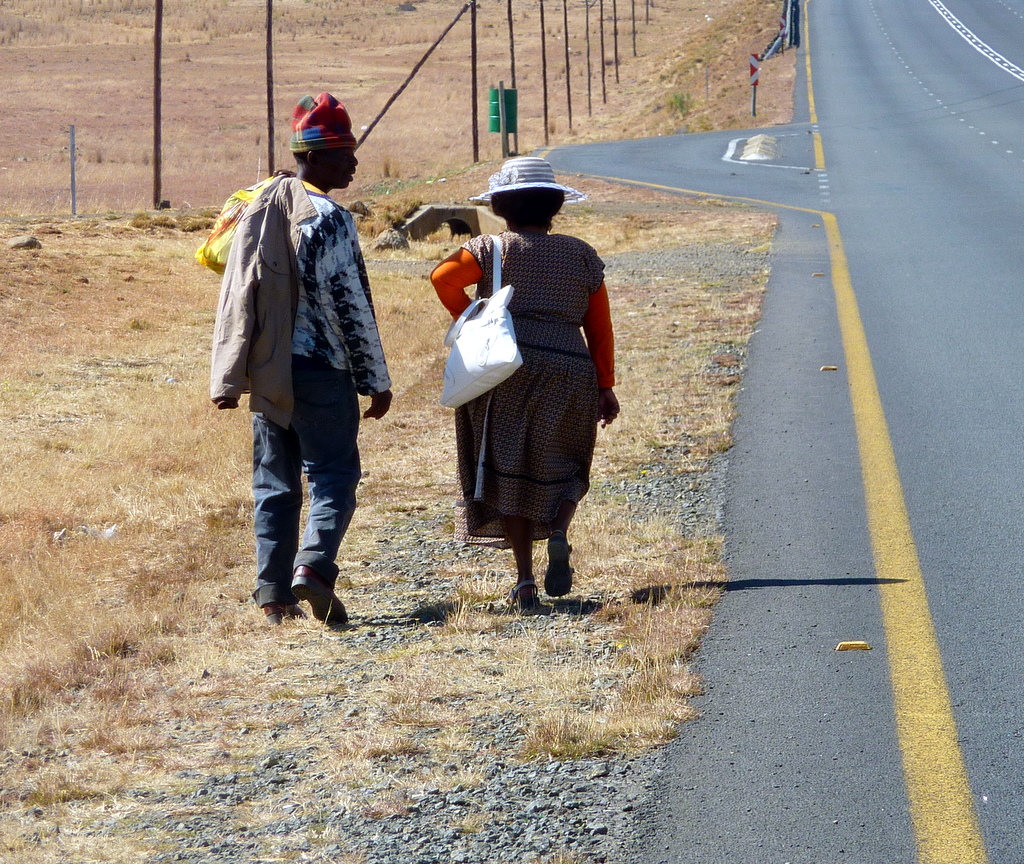
Lesotho was, expectantly, the pearl of this tour. The country, the land, the people and the culture were still pristine. An hour after you pass Maseru, the small capital town right at the border with South Africa you enter into the world of mountains where you're not considered weird if you don't have a credit card and a cell phone.
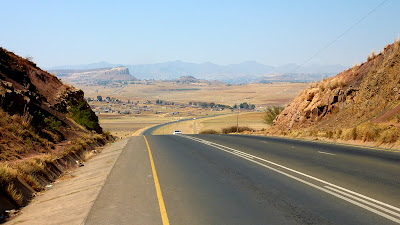
Great road ...

.. and scenery
From Maseru I took road #A2 and #A3 going close to Mohale dam, through Thaba Tseka and Likalaneng, joining #A1 near Mokhotlong and turning right on #A14 to Sani pass. It is 350 km, the first half is beautifully paved, the rest is a dirt road, sometimes really awful, especially where there were some "upgrade" works. The gradients are high, they don't know anything less than 10% in Lesotho, with excursions up to 18% (once my altimeter measured even 39%, but I will disregard it - the wind probably had some effect on pressure measurement). Fortunately, after every climb, there is also a descent: see the VIDEO.

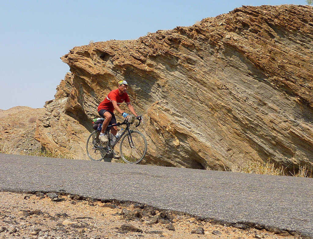
Up the Blue Mountains pass
A pic before the downhill
The configuration is very hilly, you're riding up and down all the time. There are 9 bigger passes,
Bushmen's pass (2268m), Molimo Nthuse (2318m), Blue Mountains pass (2634m), Cheche's pass (2645m), Pass of Jackals (2692m), Mokhoabong (2880m), Menoaneng (3014m), Kotisephole (3240m) and Sani pass (2873m), but to come from one to the other there are some "intermediate" climbs not much easier then the real ones. Sani pass marks the border with South Africa and is not actually a pass if you are coming from Lesotho, you are just descending form the pass at 3240 m.
Still ploughing with oxen.
Balaclava, blanket and rubber boots: the Lesotho shepherd.

Typical huts in Lesotho

It's also difficult to find a flat space to put a tent - all the flat parts are either used to grow corn, or are directly by the side of the road or in a few rare river valleys, where there's nothing to hide you from people walking about. I camped twice in Lesotho and both times a big crowd of children gathered by my tent in the morning and after I packed they followed me, running along the bike in their rubber boots, until the road became steep and they got exhausted. It was a lot of fun for me, and, judging from their laughter, for them too (the VIDEO ).
Children at my morning camp. See the VIDEO
Lesotho vista

Basotho village

View from the pass

Day 21: 102 km. Day 22: 87 km. Total: 2942 km.