North South Africa

5 September 2010

The stories that I heard about safety in South Africa were full of warnings about robbery, or worse, and all of them had one clear message: don't ever camp wild in the bush. Well, I broke that good practice already on my first night in the country. The fence that is just 20 m from the road makes it hard to find a good camping place, so it took a while before I made a camp in a ditch right by the side of the road, invisible to the traffic - or at least that was what I hoped.
A village in the north of SA

Garderobe on display
On one occasion a young white man warned me about the "location", the black township, which I should avoid or cycle fast through. Terrified by all such robbery stories I had wrapped a couple of 100 Euro banknotes in plastic and had hidden them in my shoes. When I inspected them one of the following mornings, the banknotes had discolored as if they were forgotten in a washing machine. Jesus! Another one of my Mr. Bean episodes! Fortunately, I managed to change them in a bank in Zeerust. They're their problem now, and it serves them right, as they charged me outrageous 80 rands just for commission.
The "location"

In da tent
It was still considerably hot during the day in South Africa, above 30 °C, but the nights became much colder. At the sunrise after one particularly cold night that I spend wild camping in a tent, I got out to check what my thermometer showed. I was shocked to see it was -6 °C. In the tent it was probably warmer, but a layer of ice that accumulated inside tent walls, was a testimony that it was well below freezing. And I was in a summer sleeping bag! That morning, as I crowled out of the tent, I stumbled upon the tent guyline and broke the front tent pole. It was easy, though, to make a splint using the spare tent peg and a piece of duct tape, but now I was unable to fold the pole and store it in a tent pouch. However, I foud an excellent use of the repaired pole: I put it at the back so that it was sticking half a metre out into the road, preventing the cars to come too close. 
Breakfast from Paul's magic kitchen at Pippa's in Bultfontain
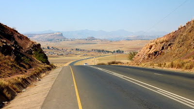
A SA vista
  
And another one

Luckily, I didn't ride over one of these.

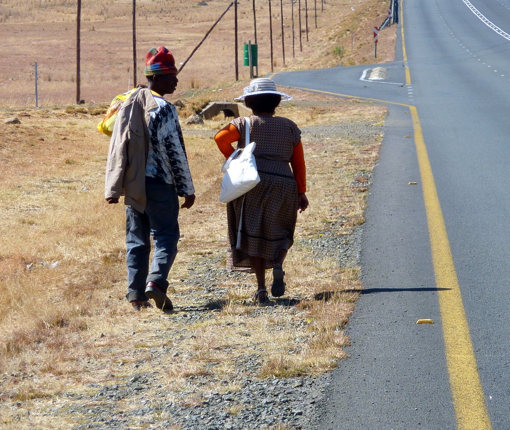
Taba Nchu residents.

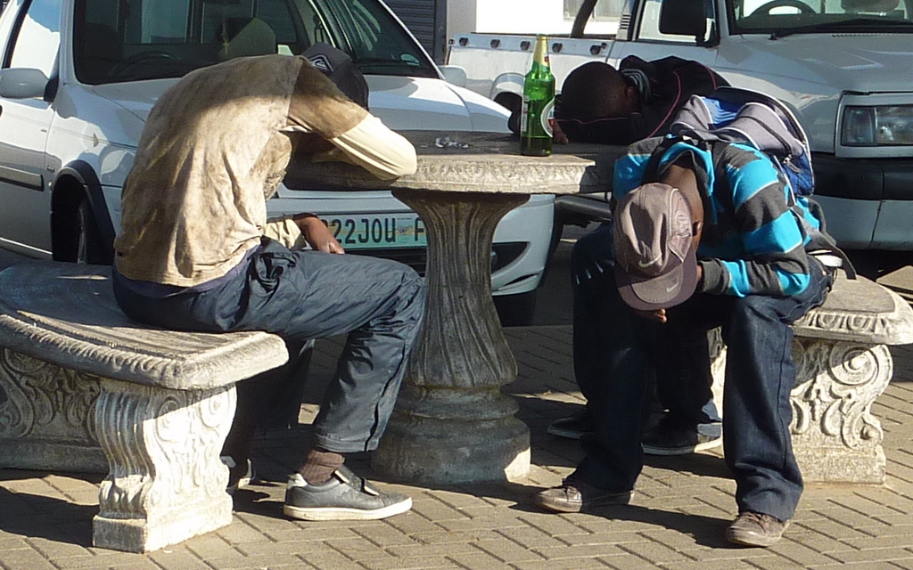
Hard night's morning in Bluemfontain. Springboks lost against wallabies.

Day 15: 111 km. Day 16: 106 km. Day 17: 159 km. Day 18: 129 km. Day 19: 103 km. Day 20: 135 km. Total: 2707 km.

Africa, Animals, Safety

8 September 2010

My room 101 nightmare is to be eaten alive by a lion. A bicycle trip in Africa seemed like a good therapeutic treatment to get rid of that fear. However, not only I didn't see any lions, but saw relatively few animals in general. And the ones that were there, were fast to run away as soon as I approached.
The most numerous were warthogs. I really liked them. With their solid, powerful bodies and uplifted tail with a haired tip, I found them really beautiful. They were usually foraging by the side of the road and when they saw me rushed straight into the fence and after several attempts managed to push through. My second best favorite was a mountain zebra that I met while climbing on the dirt road of Namib Nauklft NP. It followed me or run in front of me for about 2 kilometers until it got fed up by my slow pace. Then there were a couple of ostriches, a young eland, a few dic-dics, a jackal, a herd of oryxes, kudus and hartebeests along the fence of a game park, and quite a few species of birds. Most of the animals, though, I saw as a road kill.
Most of the big game is obviously safely confined to a few fenced game parks and riding across Africa, at least on the main roads like the ones I took, is completely safe. The biggest animal danger probably comes from the other side of animal scale: a guy I met in a hostel in Durban had been bitten by a small jumping spider, and it left him without a piece of breast and a terribly looking leg that the doctors were still fighting for.
I was also worried about a different kind of animal, the homo sapiens. The kind that drives in a car was probably my greatest threat. I developed some particular techniques to avoid being run over from behind. The obvious one is to have a mirror. The other was to lift my hand up as I saw them in the mirror (or heard them coming) and give them signs to slow down. It helped sometimes, and sometimes it made them even more annoyed. The best strategy was to stick a tent pole at the rear rack so that it was half a meter sticking into the traffic lane. Not a single car - including the big trucks and ever-annoying buses - ever drove close enough to touch the pole. 

Oh, Lesotho

12 September 2010

Lesotho was, expectantly, the pearl of this tour. The country, the land, the people and the culture were still pristine. An hour after you pass Maseru, the small capital town right at the border with South Africa you enter into the world of mountains where you're not considered weird if you don't have a credit card and a cell phone.
Great road ...

.. and scenery
From Maseru I took road #A2 and #A3 going close to Mohale dam, through Thaba Tseka and Likalaneng, joining #A1 near Mokhotlong and turning right on #A14 to Sani pass. It is 350 km, the first half is beautifully paved, the rest is a dirt road, sometimes really awful, especially where there were some "upgrade" works. The gradients are high, they don't know anything less than 10% in Lesotho, with excursions up to 18% (once my altimeter measured even 39%, but I will disregard it - the wind probably had some effect on pressure measurement). Fortunately, after every climb, there is also a descent: see the VIDEO.

Up the Blue Mountains pass
A pic before the downhill
The configuration is very hilly, you're riding up and down all the time. There are 9 bigger passes,
Bushmen's pass (2268m), Molimo Nthuse (2318m), Blue Mountains pass (2634m), Cheche's pass (2645m), Pass of Jackals (2692m), Mokhoabong (2880m), Menoaneng (3014m), Kotisephole (3240m) and Sani pass (2873m), but to come from one to the other there are some "intermediate" climbs not much easier then the real ones. Sani pass marks the border with South Africa and is not actually a pass if you are coming from Lesotho, you are just descending form the pass at 3240 m.
Still ploughing with oxen.
Balaclava, blanket and rubber boots: the Lesotho shepherd.

Typical huts in Lesotho

It's also difficult to find a flat space to put a tent - all the flat parts are either used to grow corn, or are directly by the side of the road or in a few rare river valleys, where there's nothing to hide you from people walking about. I camped twice in Lesotho and both times a big crowd of children gathered by my tent in the morning and after I packed they followed me, running along the bike in their rubber boots, until the road became steep and they got exhausted. It was a lot of fun for me, and, judging from their laughter, for them too (the VIDEO ).
Children at my morning camp. See the VIDEO
Lesotho vista

Basotho village

View from the pass

Day 21: 102 km. Day 22: 87 km. Total: 2942 km.

Oh, Lesotho, Lesotho

16 September 2010

Apart form the puncture on day 19, I've been lucky with mechanical problems. My rear tire had started to show some signs of wear already on the day 4, when I hit the dirt road of Namib-Naukluft, but it gave me no worries there after and I forgot about it. But, on Lesotho's dirt and steep roads, it started to disintegrate.
Village

New road before Thaba Tseka
The problem became apparent as I was climbing the Mokhoabong pass. There were some upgrading road works, which rendered the road particularly miserable. The people working there seemed surprised to see me riding a bike and they frequently asked me why I don't take a taxi. As the road continued up and up with a new section of mountain ridge showing after every bend, I started to ask myself the same question. When a truck stopped and the driver said he could give me the lift to Thaba Tseka, I had to summon the last bits of my will to say no. I actually said "no" mechanically, if he'd persisted or said something like "Are you sure?", I would probably take the best offer of the lifetime.
Agavas
10 kilometers further there was the end of road works and the start of asphalt. I was relieved - and proud. Then, when I checked the pressure of the rear tire, I saw that the thread had cracked, showing the tire casing underneath.  It was essentially the same thing that happened in Asia, just that now the cracks were all around the tire perimeter. As a temporary measure, I patched the cracks with duck tape.
A rare river valley
That night in a guesthouse in Thaba Tseka I couldn't get much sleep. The continuation of the trip looked questionable. I didn't expect the tire to last on gravel road more then 50, maybe 100 km. There was no way I could find such a tire (or any kind of tire) in Lesotho and I was at least 300 km from the nearest bigger town in South Africa. Taking a lift would ruin the elegance and purity of the tour, which was now taking shape of an epic continent crossing. Finally, I decided that night that I would walk the last part if I had to. I was ahead of the plan for 7 days, so it did not look so unreasonable. Especially not during the night. Ideas have more grandeur when they are thought during the night. In the morning light they look much thinner and paler.
Duck tape makes miracles
I must admit I had some luck too: the next morning I narrowly missed the only daily bus toward Linakaneng and the taxis going there were not scheduled until afternoon. So I was practically forced to continue on a bike. Asphalt finished 100 m after the town, but the dirt road didn't seem that bad, and I continued riding, veeeery veeery carefully, standing on pedals most of the time and walking the bike when there were any signs of bigger stones on the road. Every 5 km I would stop, check the tire and re-patch the cracks if necessary. The 5 km intervals were excellent choice. The intervals were short enough so that I could assess the progress of the damage to the tire, but also long enough that my progress on the road seemed fast. Very soon I had 15 km, then 20, then 30, 40 km behind me. At the end of the day I made 54 km, and I didn't even walk all that much. My confidence was growing and the tour seemed to have been saved.
The village performers . See the Video

At 3000 m
I needed two more days to the Sani pass. The slow pace and 5 km intervals of re-patching were making miracles. Only possible problem now might be that I could run out of duck tape. The second day I made it through the 3040 m pass just at the time when a storm started to form. I found refuge in a St. Joseph's "guesthouse for self-catering guests". I didn't ask what that meant, but I self-catered myself with the guesthouse's coffee. I think I deserved it, however, since I helped the owner with solving the exercises for his math exam. If I ever decide to immigrate from Slovenia, now I know what I'll do: I'll open the math repetition class at Rafolatsana village in Lesotho.

Basotho dwelling
Down to the river

Another shepherd

Road toward Sani pass - a piece of cake, if you have enough duck tape

To the 3240 m - pass
The final day to Sani pass was a piece of cake. There was the highest pass to conquer (3240m), but the road was excellent, despite what they told me in Thaba Tseka. You should never believe what non-cyclists tell you about the road conditions. When they say the road is flat, it will be hilly, and if they say the road is awful, it will be smooth. At the Sani pass I hired a cottage with a fireplace that gave me lot of headaches. Everybody who comes to Sani pass stays there and spends the evening in the "Highest pub in Africa".
Morning at Sani pass

Sani pass

Day 23: 54 km. Day 24: 43 km. Day 25: 46 km. Total: 3045 km.

Sani pass to Durban

20 September 2010

The ride down from Sani pass was a sort of "Lord of the Rings" type of experience. The mist that forms from the humid air ascending up the Drakenburg cliffs engulfs the winding road and makes a special environment for lush, colorful vegetation. The road was terrible, forcing me to walk the bike downhill for much of the time. The slow pace is beneficial, however, since it enables you to fully savor this incredible landscape.
Top of Sani pass

... in the middle ...

... at the bottom ...


my path on Sani pass road

I expected the dirt road to end at the South African immigration, which is 14 km down the pass, but, no, they decided to "upgrade" the road again for another 24 km. I wasn't much upset about that, anyway, the Murphy law couldn't bother me any more. The final stage to the Indian ocean goes through the hills, covered mostly with sugar cane fields, and although it was a difficult roller-coaster ride, everything was forgotten once I stood on the ocean beach, celebrating the victory at the ending point of the trip.
Township

Sugar cane harvest
Indian ocean - THE END

Day 26: 69 km. Day 27: 130 km. Day 28: 64 km. Total: 3307 km.